
Laser Scanning Systems - Fundamentals, Systems, and Use Cases
Point clouds and laser scanning are no longer exotic tools, they've become standard instruments in surveying and planning. The goal is to capture real-world environments in 3D as precisely and efficiently as possible, serving as a foundation for planning, documentation, or construction. Whether in building construction, infrastructure, or heritage conservation, this technology is used everywhere. How the real world is transformed into millions or even billions of measurement points depends on the system used, and that’s where things can become confusing. Especially for beginners, it's not easy to keep track.
In this article, we take a look at the following questions: What scanning systems are available and how do they differ? When is each system particularly suitable? What matters when it comes to accuracy and data quality? What kind of investment should be expected?
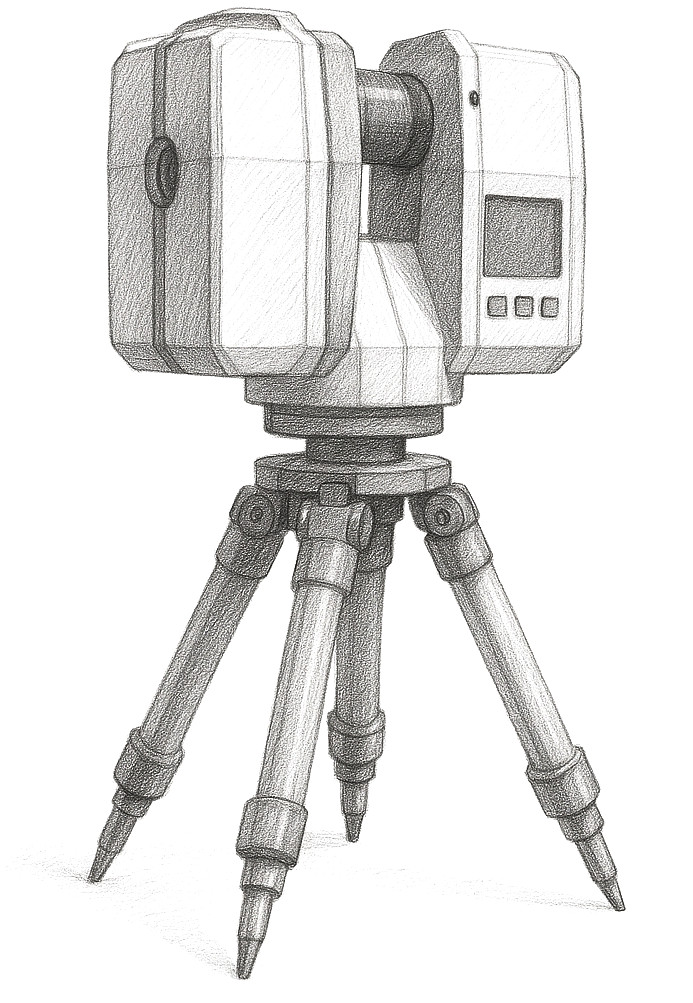
Terrestrial Scanners: Precision from Fixed Positions
Terrestrial laser scanners are designed for professional use. They are used in a stationary position, usually mounted on a tripod, and deliver especially precise point clouds, ideal for highly detailed surveys. However, from each scanning position, they only capture what is directly in their line of sight. That’s why scan positions are typically planned in advance and then processed one after the other. Later on, the individual scans are combined on the computer into a single point cloud in a process called registration.
To ensure this works well, markers are often used, such as stickers with coded positions or small objects that the software can clearly identify. Alternatively, registration can also be done entirely without markers, using software that compares overlapping parts of the scans. For larger projects, this can lead to small, systematic deviations.
Examples of commonly used models and their range:
- FARO Focus Premium (up to 400 m)
- Leica RTC360 (up to 130 m)
- Z+F Imager 5024 (up to 365 m)
- RIEGL VZ-600i (up to 1000 m)
- Trimble X9 (up to 150 m)
Good to know: Achieving dense point coverage at long range requires a lot of time. Depending on the situation, it may be more practical to limit the scan area to a smaller field of view. If the terrain is easily accessible, a range of just 30 meters is often enough to achieve solid coverage in a reasonable amount of time.
In terms of accuracy and resolution, all the devices mentioned are generally on a similar level. The data sheets offer a good first overview, but should be read with some caution: specifications about accuracy often refer to clearly defined test scenarios and individual measurement points. Likewise, resolution is usually based on a specific reference distance.
For a realistic assessment of accuracy, other factors also come into play, for example, reflective surfaces, the size of the project, how accessible the terrain is, which registration method is used (with markers or cloud-to-cloud), and how the scan positions are distributed. For specialized tasks such as flatness analysis or determining inclinations, the quality of the tilt sensor is also critical.
The greatest advantage of these scanners lies in their high measurement accuracy and dense point distribution. Even under challenging lighting conditions, they deliver reliable results, although color capture can sometimes be limited.
However, the effort involved is considerable. Multiple scan positions are needed to obtain complete models, and this takes time. If maximum accuracy is not required, mobile systems can be more efficient. There are also significant price differences between devices, depending on the manufacturer and features.
Cost range: Terrestrial scanners fall into the higher price segment. They are aimed at professional users and deliver excellent data quality in return. Purchase costs usually exceed the five-figure range. A tip: if you're interested in a specific model, it’s worth asking the manufacturer about used units. These are often certified demo devices or older models sold during product transitions. Since the underlying technology doesn't change fundamentally all the time, such offers often provide great value for money.
Mobile Scanners: Flexibility and Speed
Mobile scanners typically use what's known as SLAM technology and are designed to be used while moving, for example, on the back or with a shoulder harness. This makes it easy to quickly capture hard-to-access indoor spaces. "SLAM" stands for "Simultaneous Localization and Mapping," meaning the scanner determines its own position while simultaneously mapping the environment during movement. Over longer distances, small errors can accumulate. That’s why manufacturers often provide recommendations for optimal scanning paths. It’s common to start at a precisely known point and return to it at the end. This so-called "loop closure" helps correct potential errors afterward.
This method is particularly fast and ideal for large interior spaces or hard-to-reach areas. However, for the scanner to properly orient itself, the environment needs a certain amount of structure. Wide, open outdoor areas without distinctive facades are more difficult to capture.
Examples:
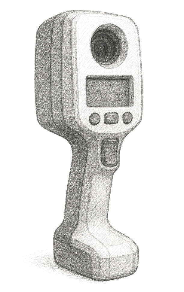 A well-known system is the NavVis VLX, a wearable device with high scanning speed, excellent detail capture, and the ability to simultaneously produce panoramic images. The FARO Orbis Premium also offers a mobile solution with modern SLAM technology and efficient data capture. A particularly practical feature: it can also be used in so-called hybrid mode, where it is mounted on a tripod to generate even more precise point clouds. The Leica BLK2GO is a handheld scanner especially suited for quick indoor use. The product line can also be combined with a drone, for example, for automated scan routes or building flyovers.
The biggest advantage of these scanners is clearly their speed and accessibility. Large areas or complex buildings can be captured in a very short time (up to 20,000 m² per day). Data processing is usually handled by the accompanying software, which automates many steps. To increase accuracy or integrate gerreferences, additional reference markers can be used. The devices themselves are generally compact and easy to transport.
For many applications, such as as-built documentation or digital facility management, mobile scanners deliver excellent results. However, when it comes to maximum accuracy, for example in production planning, they still face limitations. That said, the technology is evolving rapidly. With each new generation, accuracy improves and gets closer to that of stationary scanners.
Cost range: Mobile scanners also fall within the professional price range. However, the price spectrum is broad. As a general rule, you should also expect a five-figure investment here.
Mobile Mapping Systems: Efficiency for Large Areas
When large outdoor areas need to be captured, so-called mobile mapping systems come into play. These are mounted on vehicles or drones and combine laser scanners, cameras, as well as GNSS and IMU sensors.
Examples:
- Leica Pegasus TRK
- RIEGL VMX-2HA
These systems deliver precise geodata with impressively high area coverage, making them ideal for infrastructure projects, urban planning, resource extraction, or applications in agriculture and forestry. Due to their size and high cost, they are typically reserved for specialized outdoor operations.
Cost range: Mobile mapping systems are among the most expensive solutions in the field of laser scanning. Their acquisition is especially worthwhile where large areas need to be documented quickly and in detail, for example, in large-scale infrastructure projects.
Drones and Photogrammetry: Aerial Overview
Drones equipped with cameras capture aerial images that are later converted into point clouds and 3D models using photogrammetry. This is especially worthwhile for hard-to-reach or large-scale objects.
The final data quality depends heavily on the camera system used. Professional drones offer stable camera control during flight and can be equipped with various camera options. Drones with fixed, built-in cameras are generally not recommended for professional use as they technically work, but usually only deliver usable results for basic applications. The environment also plays a major role: rapidly changing lighting conditions or very uniform surfaces (like white walls) can significantly reduce quality. However, these systems are especially well-suited for heritage preservation or the documentation of historical structures. They’re also used in rooftop solar planning or to map bridge damage.
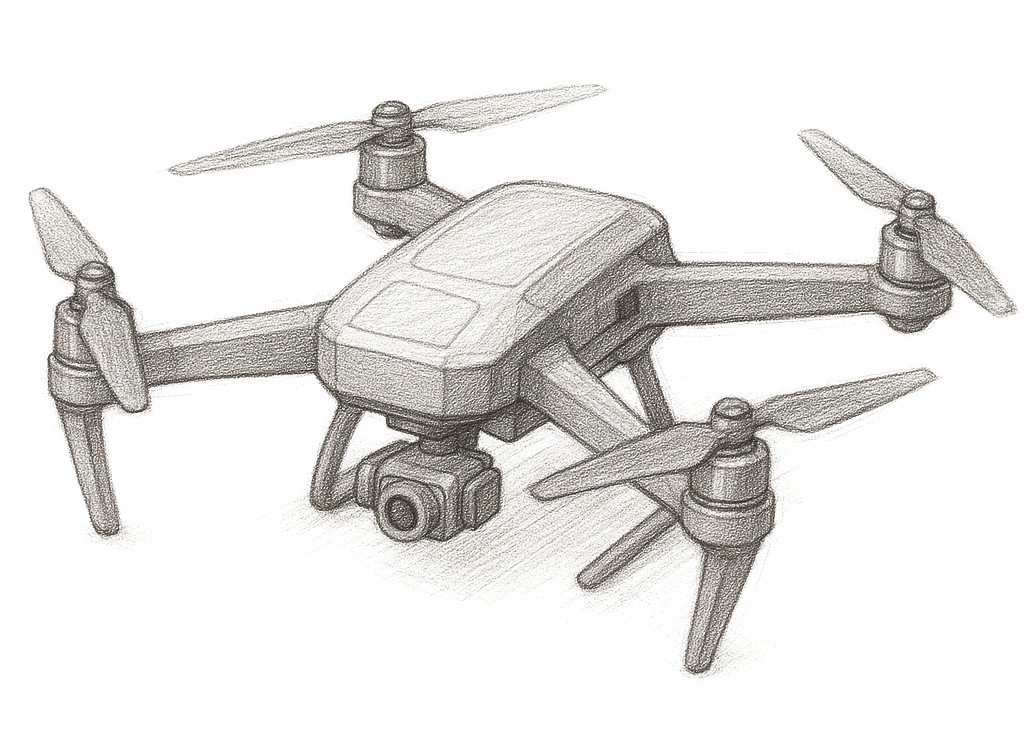
The biggest advantage of drones lies in their ability to efficiently capture hard-to-access or potentially hazardous areas. They’re also significantly cheaper than terrestrial laser scanners and provide a good overview of large areas. However, they are weather-dependent and subject to legal regulations. Depending on the location, special permits may be required, and in many cases, the pilot must have specific training or certification.
To ensure the collected data can later be used in software solutions like Autodesk Revit, some level of post-processing is usually required.
Cost range: Drone systems vary widely in price depending on the model, camera, and software. A small tip: the software used for data processing is usually sold separately. For beginners, tools like Recap Photo or the basic version of Agisoft Metashape are good options. The professional software Reality Capture is considered an industry standard, and is even free for companies with less than one million USD in annual revenue.
Smartphones with LiDAR: Pocket-Sized Scanning Devices
Modern smartphones, such as the Pro models of the iPhone, are now equipped with LiDAR sensors. These allow for simple 3D scans, ideal for quick reality capture applications or capturing point clouds in small indoor spaces.
 Smartphones with LiDAR offer high availability and are very easy to use. However, in terms of accuracy and range, they quickly reach their limits. Capturing larger areas, multiple rooms, or entire floors is often difficult. As such, they are only partially suitable for professional surveying or for integrating precise data into programs like Autodesk Revit.
That said, for first steps with point clouds or basic augmented reality applications, they are an interesting option. There are also systems like Vidoc that enhance smartphones with additional sensors. These can significantly improve results and expand the range of potential use cases.
Cost range: Compared to professional scanners, smartphone-based solutions are significantly more affordable. They’re a good choice for simple tasks or for gaining initial experience in the field of reality capture.
Conclusion
Which laser scanning system is best depends entirely on the specific project requirements. Terrestrial scanners provide the highest accuracy and are ideal for detailed as-built documentation. Mobile scanners excel in speed but fall slightly behind in precision. For large-scale infrastructure projects, mobile mapping systems are the best choice. Drones are particularly suited for hard-to-reach or hazardous areas. And for those who want something simple, smartphones offer an easy entry point, but usually aren’t sufficient for professional tasks.
| System Type | Strengths | Limitations | Cost |
| Terrestrial Scanner | Highest accuracy, highly detailed point clouds | Time-intensive, expensive | High-end, professional class |
| Mobile Scanner | Fast, great for indoor coverage | Lower accuracy, SLAM-based drift | High-end, professional class |
| Mobile Mapping | Comprehensive area coverage, accurate georeferencing | Outdoor use only, very costly | Very high investment cost |
| Drone/Photogrammetry | Great overview, access to hard-to-reach areas | Weather-dependent, may require permits, post-processing required | Mid- to high-priced |
| Smartphone with LiDAR | Low entry barrier, suited for simple scenarios | Limited accuracy and range | Affordable, entry-level |
System Selection Recommendations:
- For detailed as-built documentation: terrestrial scanner
- For fast, flexible indoor scans: mobile scanner
- For infrastructure and large-area mapping: mobile mapping systems
- For roof inspections, heritage sites, hard-to-access areas: drones with photogrammetry
- For spontaneous scans and AR tests: smartphone with LiDAR